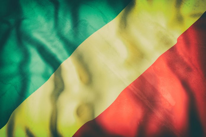
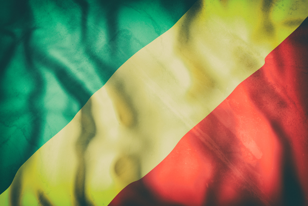
The Republic of the Congo also known as Congo
Republic or Congo-Brazzaville, is a country located in Central Africa. It is
bordered by Gabon, Cameroon, the Central African Republic, the Democratic
Republic of the Congo and the Angolan enclave of Cabinda. The region was dominated by Bantu-speaking tribes,
who built trade links leading into the Congo River basin. Congo-Brazzaville was
formerly part of the French colony of Equatorial Africa. Upon independence in
1960, the former colony of French Congo became the Republic of the Congo. Bantu-speaking peoples who founded tribes during the
Bantu expansions largely displaced and absorbed the earliest inhabitants of the
region, the Pygmy people, in about 1500 BC. The Bakongo, a Bantu ethnicity that
also occupied parts of present-day Angola, Gabon and Democratic Republic of the
Congo, formed the basis for ethnic affinities and rivalries among those
countries.
After the Republic of the Congo received full
independence from France on August 15, 1960, Fulbert Youlou ruled as the
country’s first president until labour elements and rival political parties
instigated a three-day uprising that ousted him. The Congolese military took
charge of the country briefly and installed a civilian provisional government
headed by Alphonse Massamba-Débat.
GEOGRAPHY
Congo is located in the central-western part of
sub-Saharan Africa, sharing borders with
the Democratic Republic of Congo to the south and east; Gabon to the west;
Cameroon and the Central African Republic to the north, and Cabinda (Angola) to
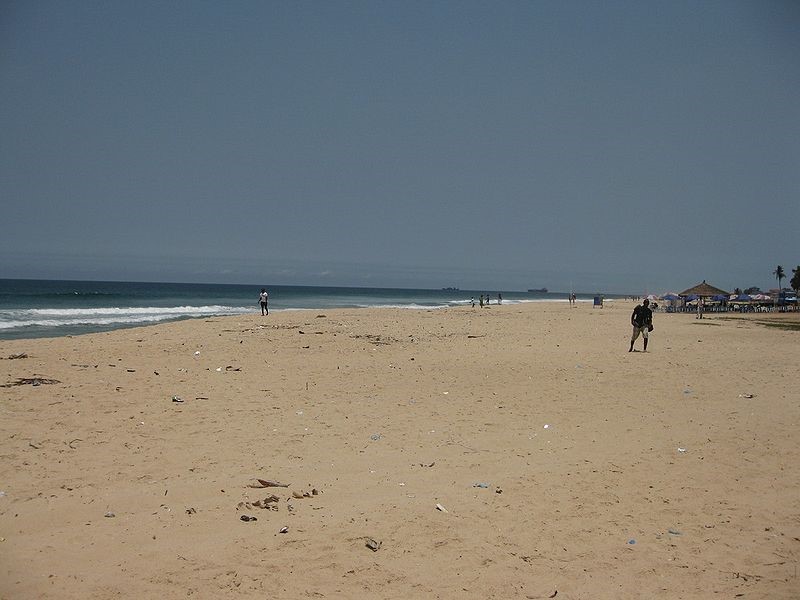
the southwest. It has a short coast on the Atlantic Ocean. The capital, Brazzaville, is located on the Congo
River, in the south of the country, immediately across from Kinshasa, the
capital of the Democratic Republic of the Congo. Because the country is located on the Equator, the
climate is consistent year-round, with the average day temperature being a
humid 24 °C (75 °F) and nights generally between 16 °C (61 °F) and 21 °C (70
°F).
DEMOGRAPHICS
The Republic of the Congo’s sparse population is
concentrated in the southwestern portion of the country, leaving the vast areas
of tropical jungle in the north virtually uninhabited. Thus, Congo is one of
the most urbanized countries in Africa, with 70% of its total population living
in a few urban areas, namely in Brazzaville, Pointe-Noire or one of the small
cities or villages lining the 534-kilometre (332 mi) railway, which connects
the two cities. In rural areas, industrial and commercial activity has declined
rapidly in recent years, leaving rural economies dependent on the government
for support and subsistence.
Congo Brazzaville’s population is quite diverse with
about 62 languages. in the country but can be grouped into three categories.
The Kongo are the largest ethnic group and form roughly half of the population.
The most significant subgroups of the Kongo are Laari in Brazzaville and Pool
regions and Vili around Pointe-Noire and along the Atlantic coast. The second
largest group are the Teke who live to the north of Brazzaville with 17% of the
population. Boulangui (M’Boshi) live in northwest and in Brazzaville and form
12% of the population. Pygmies make up 2% of Congo’s population.
The people of Republic of the Congo are largely a mix
of Catholics and Protestants, who collectively account for 50.0%. The majority
of Christians in the country are Catholic, while the remaining comprises
various other Christian denominations. Followers of Islam make up less than 2%
of the population, and this is primarily due to an influx of foreign workers
into the urban centers.
ECONOMY
The economy is a mixture of village agriculture and
handicrafts, an industrial sector based largely on petroleum support services, and a government
characterized by budget problems and over-staffing. Petroleum extraction has
supplanted forestry as the mainstay of the economy. In 2008, oil sector
accounted for 65% of the GDP, 85% of government revenue, and 92% of
exports.[31] The country also has large untapped mineral wealth.
Natural gas and diamonds are also recent major
Congolese exports, although Congo was excluded from the Kimberley Process in
2004 amid allegations that most of its diamond exports were in fact being
smuggled out of the neighboring Democratic Republic of Congo; it was
re-admitted to the group in 2007.
Congolese exports, although Congo was excluded from the Kimberley Process in
2004 amid allegations that most of its diamond exports were in fact being
smuggled out of the neighboring Democratic Republic of Congo; it was
re-admitted to the group in 2007.
The Republic of the Congo also has large untapped
base metal, gold, iron and phosphate deposits.[35] The country is a member of
the Organization for the Harmonization of Business Law in Africa (OHADA).[36]
The Congolese government signed an agreement in 2009 to lease 200,000 hectares
of land to South African farmers to reduce its dependence on imports.[37][38]
Petroleum and mining are the major export industries,
followed by forestry and commercial agriculture. Light manufacturing (mostly
shoes), sugar processing, and assembly industries assumed greater importance in
the 1980s. These activities, however, employed only a small fraction of the
labour force, most of which worked in agriculture and the non salaried informal
urban economy.
CULTURAL LIFE
Pre-colonial artistic expression emphasized
ceremonial music, dance, sculpture, and oral literature. Christianity and
colonialism had a great impact on these art forms. The carving of ritual
objects became commercialized, and music and dance altered as a result of the
introduction of Western instruments and musical styles.
ceremonial music, dance, sculpture, and oral literature. Christianity and
colonialism had a great impact on these art forms. The carving of ritual
objects became commercialized, and music and dance altered as a result of the
introduction of Western instruments and musical styles.
In the 1980s the Brazzaville region, along with
Kinshasa, across the river in the Democratic Republic of the Congo, became a
vital centre for the production of contemporary African music, known as
Congolese music or rumba. The genre, which mixes traditional African rhythms
and instruments with those borrowed from other cultures, enjoys widespread
popularity throughout Africa as well as around the world.
Holidays observed in Congo include those celebrated
by Christians around the world, such as Good Friday, Easter, and Christmas.
Labour Day and Independence Day are observed on May 1 and August 15,
respectively.
by Christians around the world, such as Good Friday, Easter, and Christmas.
Labour Day and Independence Day are observed on May 1 and August 15,
respectively.
There are a number of libraries in Brazzaville,
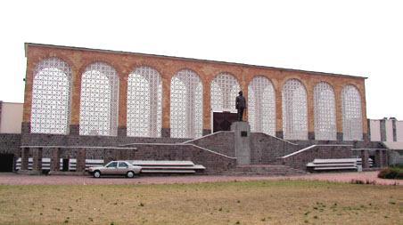
including the national library. The Marien Ngouabi Museum in Brazzaville has an
excellent collection of indigenous masks from groups throughout the Congo River
basin, particularly those of the Kongo people, who trace their ancestry back to
the Kongo kingdom that ruled parts of both modern-day Congo and Angola.
HISTORICAL SITES
Odzala-Kokoua National Park
In the heart of the world’s second largest tropical
rainforest, second only to the Amazon, lies a vast expanse of protected
frontier forest, Odzala-Kokoua National Park. Situated in the north-west of the
Republic of Congo, this 13,546 km2 of pristine wilderness is home to the
incredible biological diversity that is characteristic of such an extraordinary
and complex ecosystem.
The park was established in 1935 during the French
Colonial period but was extended in 2001, in consultation with the local
communities, to its current expanse. Odzala-Kokoua is one of three signature
areas of the 191,541km2 trans-boundary mosaic known as the Tridom project.
Declared a UNESCO Man and Biosphere Reserve in 1977 and nominated in 2008 to
become a UNESCO World Heritage Site, Odzala as a conservation priority is
unattested.
Odzala-Kokoua is a ‘frontier forest’ which harbours
some of the last extensive blocks of contiguous forest ecosystems that are
capable of supporting viable populations of large mammals. The southern part of
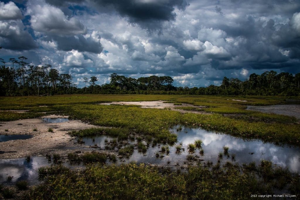
the park is predominantly a savannah-forest mosaic and forest gallery
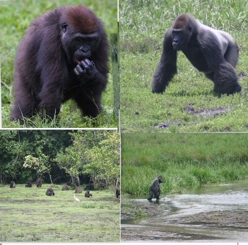
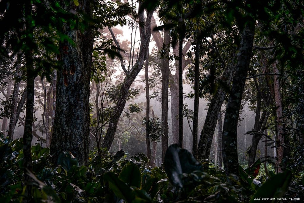
ecosystem. The centre of the park is dominated by Marantaceae Forest where a
high density of gorilla and elephant are found. Further north, the park is
covered by mature rain forest.
One of the unique aspects of this park is its
numerous clearings, called ‘bais’, that provide an opportunity to observe the
forest wildlife easily where it is normally difficult to see through the dense
vegetation in a tropical forest. The majestic Mambili River provides one of the
few access routes to the park. The Ekoutou escarpment (80km) with its lichen
forest, and Djoua swamp in the north west of the park remain some of the most
remote areas in which only a few scientific expeditions have been conducted.
The biological diversity is exceptional, including
more than 400 bird species, 114 mammal species and in excess of 4,400 varieties
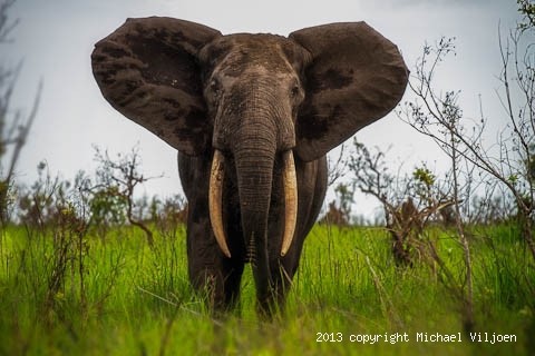
of plants. Of the 16 primate species, it is the gorilla and chimpanzee
populations on which OKNP’s reputation rests. Odzala also boasts numerous
herbivore species. These include elephants, numbering in the thousands, and a
few populations of hippopotamus.
The River Congo
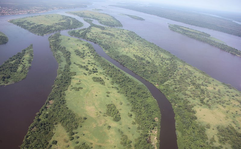
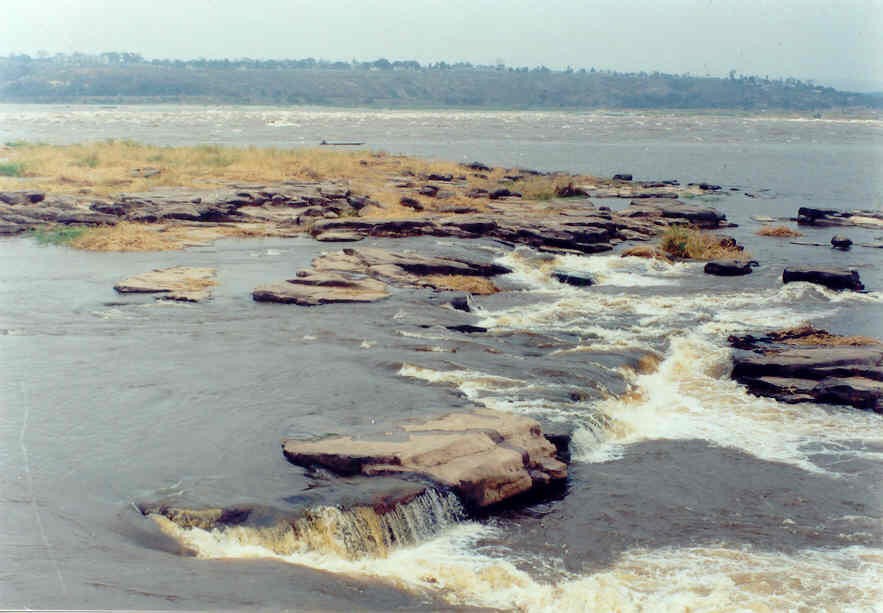
The Congo River is a river in Africa and the world’s
deepest river with measured depths in excess of 220 m (720 ft). It is the
second largest river in the world by discharge (after the Amazon). The
Congo-Chambeshi river has an overall length of 4,700 km (2,920 mi), which makes
it the ninth longest river (in terms of discharge, the Chambeshi is a tributary
of the Lualaba River, Lualaba being the name of the Congo River upstream of the
Boyoma Falls, extending for 1,800 km). Measured along the Lualaba, the Congo
River has a total length of 4,370 km (2,715 mi), The Congo Basin has a total
area of about 4 million km², or 13% of the entire African landmass.
The Congo River got its name from the Kingdom of
Kongo which was situated on the left banks of the river estuary. The kingdom is
in turn named for its Bantu population, in the 17th century reported as
Esikongo. South of the Kongo kingdom proper, lay the similarly named Kakongo
kingdom, mentioned in 1535. Abraham Ortelius in his world map of 1564 labels as
Manicongo the city at the mouth of the river. The tribal names in kongo
possibly derive from a word for a public gathering or tribal assembly.
The river and its tributaries flow through the Congo
rain forest, the second largest rain forest area in the world, second only to
the Amazon Rain forest in South America. The river also has the second-largest
flow in the world, behind the Amazon; the third-largest drainage basin of any
river, behind the Amazon and Plate rivers; and is one of the deepest rivers in
the world, at depths greater than 220 m (720 ft).
The Congo River is the most powerful river in Africa.
During the rainy season over 50,000 cubic meters (1,800,000 cu ft) of water per
second flow into the Atlantic Ocean.
During the rainy season over 50,000 cubic meters (1,800,000 cu ft) of water per
second flow into the Atlantic Ocean.
Opportunities for the Congo River and its tributaries
to generate hydro-power are therefore enormous. Scientists have calculated that
the entire Congo Basin accounts for thirteen percent of global hydro-power
potential. This would provide sufficient power for all of sub-Saharan Africa’s
electricity needs. Currently there are about forty hydro-power plants in the
Congo Basin. The largest is the Inga Falls dam, about 200 kilometres (120 mi)
southwest of Kinshasa. The prestigious Inga Project was launched in the early
1970s and at that time the first dam was completed. The plan as originally
conceived called for the construction of five dams that would have had a total
generating capacity of 34,500 megawatts. To date only two dams have been built,
which are the Inga I and Inga II, with a total of fourteen turbines.
In terms of aquatic life, the Congo River Basin has a
very high species richness, and among the highest known concentrations of
endemics. Until now, almost 700 fish species have been recorded from the
Congo River Basin, and large sections remain virtually unstudied.
very high species richness, and among the highest known concentrations of
endemics. Until now, almost 700 fish species have been recorded from the
Congo River Basin, and large sections remain virtually unstudied.
Several species of turtles, and the slender-snouted,
Nile and dwarf crocodile are native to the Congo River Basin. African manatees
inhabit the lower parts of the river.
Nile and dwarf crocodile are native to the Congo River Basin. African manatees
inhabit the lower parts of the river.
Gorge de Diosso
It was the capital of the Loango Kingdom and is home
to its rulers’ mausoleum. Roman Catholic missionaries were active in Diosso,
which had a royal palace.
to its rulers’ mausoleum. Roman Catholic missionaries were active in Diosso,
which had a royal palace.
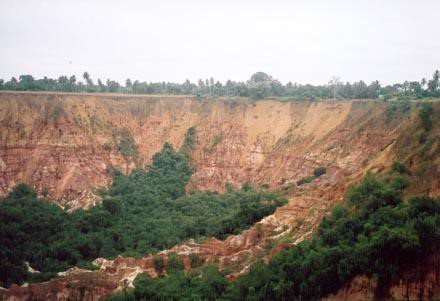
Erosion in the area has created the nearby Diosso
Gorge, known as the “Grand Canyon of the Congo”Within the gorge’s
rain forest, there are rock ridges and distinctive red rock cliffs, which can
reach up to 165 feet (50 m) in height
described Diosso Gorge as “a stunning gorge of plunging, pink
cliffs draped with green Central African jungle. According to reports,
Gamissamy Issanga, the director of environment at the Congo’s research ministry,
once approved the dumping of 1 million tonnes of oil, acids and solvents in the
gorge. The gorge is said to be inhabited by the female spirit of Mboma, who
takes the form of a snake.
Built by the Conoco petroleum company for JGI,
Tchimpounga is reputedly the largest chimpanzee sanctuary on the African
continent, treating some 125 apes
Tchimpounga is reputedly the largest chimpanzee sanctuary on the African
continent, treating some 125 apes
Founded in 1982, the ethnography and history of the
Loango Kingdom is displayed in the Mâ-Loango Regional Museum, located in
Diosso. The museum is a public institution and, as a regional branch, was
founded with the aim of protecting cultural heritage. It collects and
exhibits objects that are of historical, archaeological, ethnographic and
artistic significance, and is situated in a palace that was inhabited by Ma Moe
Loango Poaty III, king (1931-1975) of the kingdom of Loango. The museum is 20
metres (66 ft) long by 11 metres (36 ft) wide and contains rooms, hallways,
bedrooms, and the king’s bathroom. All these rooms have either been transformed
into exhibition rooms or are in reserve.
There are over 300 exhibits and documents, as well as
a dozen different collections, illustrating historical events and documents
that show the evolution of Congolese society. Objects of great artistic value
are displayed alongside simpler objects relating to everyday life that are
considered important in the study of ancient Congolese people. Traditional work
tools include hoes, axes, knives, wooden bellows, gourds, and adzes. Jewelry
and traditional clothing include loincloths, headdresses, and the Tchikumbi
costume. Domestic items are characterized by a rush mat, as well as straw and
kitchen utensils. Weapons and traps include spears, knives, crossbows, hunting
wooden bells, hunting wicker traps, and nets. Traditional objects of worship
include stone statuettes, Punu mask, the Kidumu mask, as well as the Kebe Kebe
and Mboumba figurines. Traditional musical instruments are the Yombe and Dondo
The Loufoulakari Falls
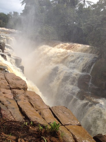
The Loufoulakari Falls lie 80 km south west of
Brazzaville in the Republic of the Congo at the confluence of the Loufoulakari
River and the Congo River surrounded by tropical rain forests.
Brazzaville in the Republic of the Congo at the confluence of the Loufoulakari
River and the Congo River surrounded by tropical rain forests.
Basilique St. Anne
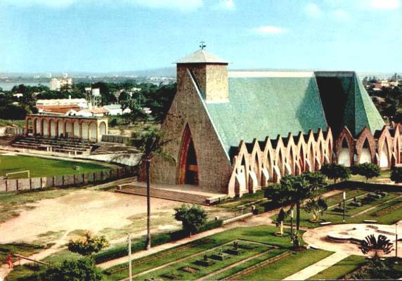
The Basilique St. Anne is a beautiful church that was
consecrated in 1949 located near the intersection of Avenue de la Paix and
Avenue de France in Poto-Poto
consecrated in 1949 located near the intersection of Avenue de la Paix and
Avenue de France in Poto-Poto
Place Felix EBOUE
Chad Félix Eboué
supported De Gaulle during the French revolution on the basis of which
he became Governor General of the Afrique Equatoriale Française (AEF) in 1940,
the first non white to achieve this position in French colonial history. Born
in 1884 in French Guiana, this descendant of African slaves was a key figure
together with René Pleven in the organization by the De Gaulle government of
the Brazzaville Conference of 1944, which took place between the January 30 and
February 8, 1944 and which did set out the new direction of French colonial
policies after World War II.
Policies
already put forward by Eboué in his 1941 book entitled “La nouvelle
politique coloniale de l’A.E.F.” This conference led to the abolition of
forced labor and the code de l’indigénat, which made the political and social
activities of the indigenous people illegal. This in turn led to the new French
constitution of the Fourth Republic approved on 27 October 1946 and the
election of the first Equatorial African members of Parliament in Paris. For Eboué
and the new French government the people in the colonies were officially part
of the French empire and had a new series of rights. A severely weakened
France, under pressure from the US, had hardly any option but to change its
colonial policies.
Pointe-Noire
Pointe-Noire is the second largest city in the
Republic of the Congo, following the capital of Brazzaville, and an autonomous
department since 2004. Before this date it was the capital of the Kouilou
region (now a separate department). It is situated on a headland between
Pointe-Noire Bay and the Atlantic Ocean. Pointe-Noire is the main commercial
centre of the country and has a population of 715,334 (2007), expanding to
well over 1 million when the entire metropolitan area is taken into account.
Pointe Noire’s (Black Point) name originated from
Portuguese navigators who saw a block of black rocks on the headland in 1484.
From then on, Pointe Noire, called Ponta Negra, became a maritime reference,
and then a small fishing village from 1883, after the French signed a treaty
with local people, Loangos.
Portuguese navigators who saw a block of black rocks on the headland in 1484.
From then on, Pointe Noire, called Ponta Negra, became a maritime reference,
and then a small fishing village from 1883, after the French signed a treaty
with local people, Loangos.
In 1910, French Equatorial Africa (Afrique
équatoriale française, AEF) was created, and French companies were allowed to
exploit the Middle Congo (modern-day Congo Brazzaville). It soon became
necessary to build a railroad that would connect Brazzaville, the terminus of
the river navigation on the Congo River and the Ubangui River, with the
Atlantic coast. As rapids make it impossible to navigate on the Congo River
past Brazzaville, and the coastal railroad terminus site had to allow for the
construction of a deep-sea port, authorities chose the site of Ponta Negra
instead of Libreville as originally envisaged. Construction of the Congo-Ocean
Railway began in 1921, and led to the foundation of Pointe-Noire on 22 May
1922.
In 1927, drinking water became available in the city,
which had about 3,000 inhabitants. The airport was built in 1932. In 1934,
Governor Raphael Antonetti inaugurated the Congo-Ocean Railway. The first
hospital was built in 1936. That same year, Bank of West Africa (BAO) opened
its first branch in the city. In 1942, the Pointe-Noire Harbour welcomed the
first ship, and made the city the AEF’s seaport.
In 1950, Pointe-Noire had 20,000 inhabitants, and
became the capital of the Middle Congo, while Brazzaville was the capital city
of the AEF. In 1957, the Middle-Congo became the Republic of Congo, although it
was still not independent. Incidents which occurred during 1958 legislative
elections led the leaders of the Democratic Union for the Defence of African
Interests (Union démocratique pour la défense des interets africains, UDDIA) to
transfer the capital to Brazzaville, since Pointe-Noire was under the influence
of political opposition.
Pointe-Noire continued growing, and was the most
modern city in 1960, when Congo gained independence. Then, the oil discovery
around 1980 re-attracted people and factories (Elf Aquitaine). The population
doubled by 1982, and reached 360,000 in 1994.
modern city in 1960, when Congo gained independence. Then, the oil discovery
around 1980 re-attracted people and factories (Elf Aquitaine). The population
doubled by 1982, and reached 360,000 in 1994.
Tchicaya U Tam’si
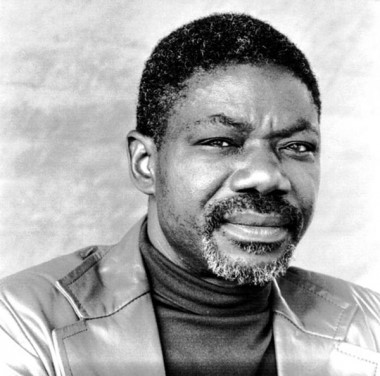
Tchicaya U Tam’si, pseudonym of Gérald Félix
Tchicaya (born August 25, 1931, Mpili,
near Brazzaville, French Equatorial Africa [now in Congo]—died April 21 or 22,
1988, Bazancourt, Oise, France), Congolese French-language writer and poet
whose work explores the relationships between victor and victim.
Tchicaya (born August 25, 1931, Mpili,
near Brazzaville, French Equatorial Africa [now in Congo]—died April 21 or 22,
1988, Bazancourt, Oise, France), Congolese French-language writer and poet
whose work explores the relationships between victor and victim.
As the son of the Congolese first deputy to the
French National Assembly, Tchicaya finished his secondary school in Orléans and
Paris. When Belgian Congo became independent, Tchicaya went to Léopoldville
(now Kinshasa) as chief editor of a new daily paper (which lasted one week).
From 1960 he worked with UNESCO in Paris.
French National Assembly, Tchicaya finished his secondary school in Orléans and
Paris. When Belgian Congo became independent, Tchicaya went to Léopoldville
(now Kinshasa) as chief editor of a new daily paper (which lasted one week).
From 1960 he worked with UNESCO in Paris.
Tchicaya’s poetry—much influenced by Surrealism and
Negritude—includes Le Mauvais Sang (1955; “Bad Blood”), Feu de brousse (1957;
Brush Fire), À triche-coeur (1960; “A Game of Cheat-Heart”), Épitomé (1962), Le
Ventre (1964; “The Belly”), L’Arc musical (1969; “The Bow Harp”), Selected
Poems (1970), and La Veste d’intérieur (1977; “The Inner Failure”). He also
published Légendes africaines (1969; “African Stories”), a collection of
folktales. His later works include a book of short stories, a novel, and two
plays.
His poetry relates, through rich and varied imagery,
the broken heritage of the African present and the roles of the Roman Catholic
church, French colonialism, and education. Through fierce and startling symbols
repetitively used like devices in oral African literature, Tchicaya expanded
his verse to make large statements about life.
the broken heritage of the African present and the roles of the Roman Catholic
church, French colonialism, and education. Through fierce and startling symbols
repetitively used like devices in oral African literature, Tchicaya expanded
his verse to make large statements about life.

